The Hays Humm - August 2021

The Hays Humm
Award Winning Online Magazine - August 2021
Tom Jones - Betsy Cross - Constance Quigley - Mimi Cavender - Steve Wilder
Banner image provided by HCMN 2021 Class Member Nancy Hernandez. Source: Illustrations from The Viviparous Quadrupeds of North America by John James and John Woodhouse Audubon, a free CC0 public domain.
We warmly welcome the 2021 Hays County Master Naturalist Class of Armadillos!
“According to spirit animal folklore, the armadillo is symbolic of protection and boundaries. Their totem presence shows that you have something great in your life!”
More from Mary
Howdy Armadillos!
If you missed the Chapter meeting in June, I announced the voting results for this year’s HCMN Class Name—you will now and forever be known as Armadillos, Class of 2021. Your totem is iconic to Texas and, in fact, is one of eight official state animals! Here are some more fun facts for you trivia lovers:
Only one species (there are 20!), Dasypus novemcinctus, the nine-banded armadillo, lives in North America.
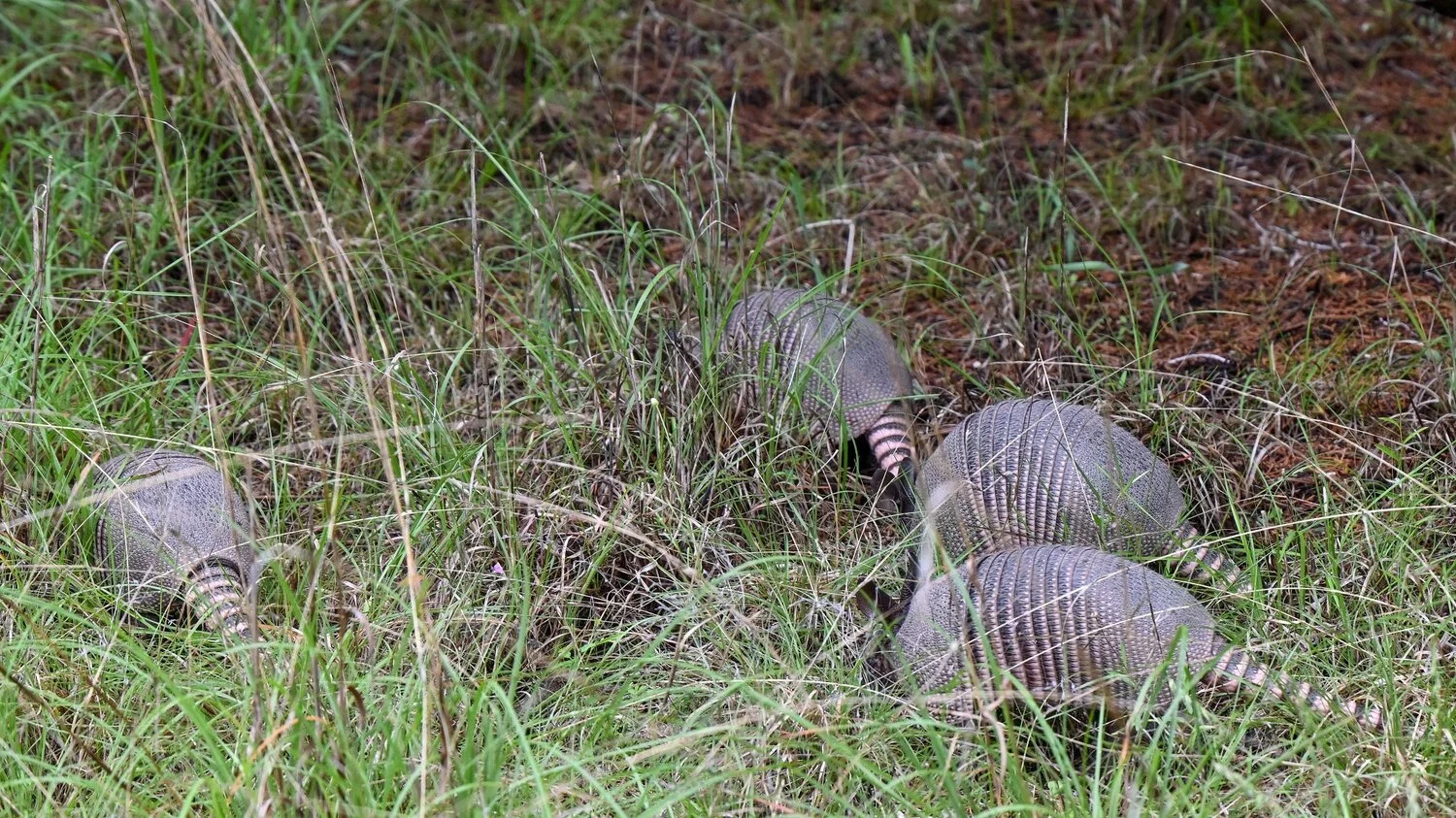
HCMN Class Member Nancy Hernandez shared this photo with permission from her friend and photographer Maureen McKeon. The four baby armadillos were in Maureen’s garden in Austin. Photo © Maureen McKeon
Armadillo is a Spanish word meaning "little armored one," referring to the bony plates covering their head, back, tail, and legs.
Because of their low metabolic rate and lack of fat stores, they are intolerant of cold temperatures, but a few have been documented as far north as Illinois and Nebraska!
They have a tendency to jump straight up in the air when startled, which (sadly) often leads to their demise on roadways.
Populations are increasing nevertheless, due to humans wiping out their natural predators: pumas, bears, and alligators.
Additional Tidbits About Our Nine-banded Armadillos
Armadillos are generally insectivores and forage for meals by frantically digging in erratic patterns, thrusting their snouts into loose soil and leaf litter. Perhaps you have seen the telltale signs of their work in your yard.
With their sensitive noses, they can detect a delicious meal of grubs, beetles, ants, termites, worms, and other invertebrates through 8 inches of soil. That’s right, 8 inches!
They are extensive burrowers and sometimes maintain up to 12 burrows in their range. Burrows are roughly 8 inches wide, 7 feet deep, and 25 feet long.
Small streams are no obstacle for the nine-banded armadillo. They can hold their breath for up to 6 minutes and can swim (or float by inflating their intestines) and “walk” along the bottom of rivers.
Breeding occurs in July, and a single egg is fertilized. But the embryo remains in a dormant state for three to four months to ensure young are not born during an unfavorable time. Once the zygote does implant in the uterus, a four month gestation period begins, during which time the zygote splits into four identical embryos. Four young are born in a burrow in March. Having developed from the same egg, all four young, always of the same sex, are identical quadruplets. Fascinating!
The newborn quadruplets remain in the burrow, living off the mother’s milk, for about three months. They begin to forage with the mother, eventually leaving after six months to a year.
Nine-banded armadillos typically live from 7 to 20 years in the wild. A single female can produce up to 56 young over the course of her life.
References: Wikipedia, The National Wildlife Federation, and Texas Parks & Wildlife.
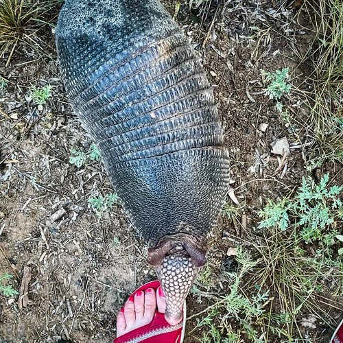
On May 22, four young armadillos, nose down in the dirt, foraged in the early morning. As I squatted down to get a better shot, the curious siblings approached, rooted around my feet, and practically crawled up into my lap. It’s the second time I’ve seen a set of armadillo quadruplets at Jacob’s Well.
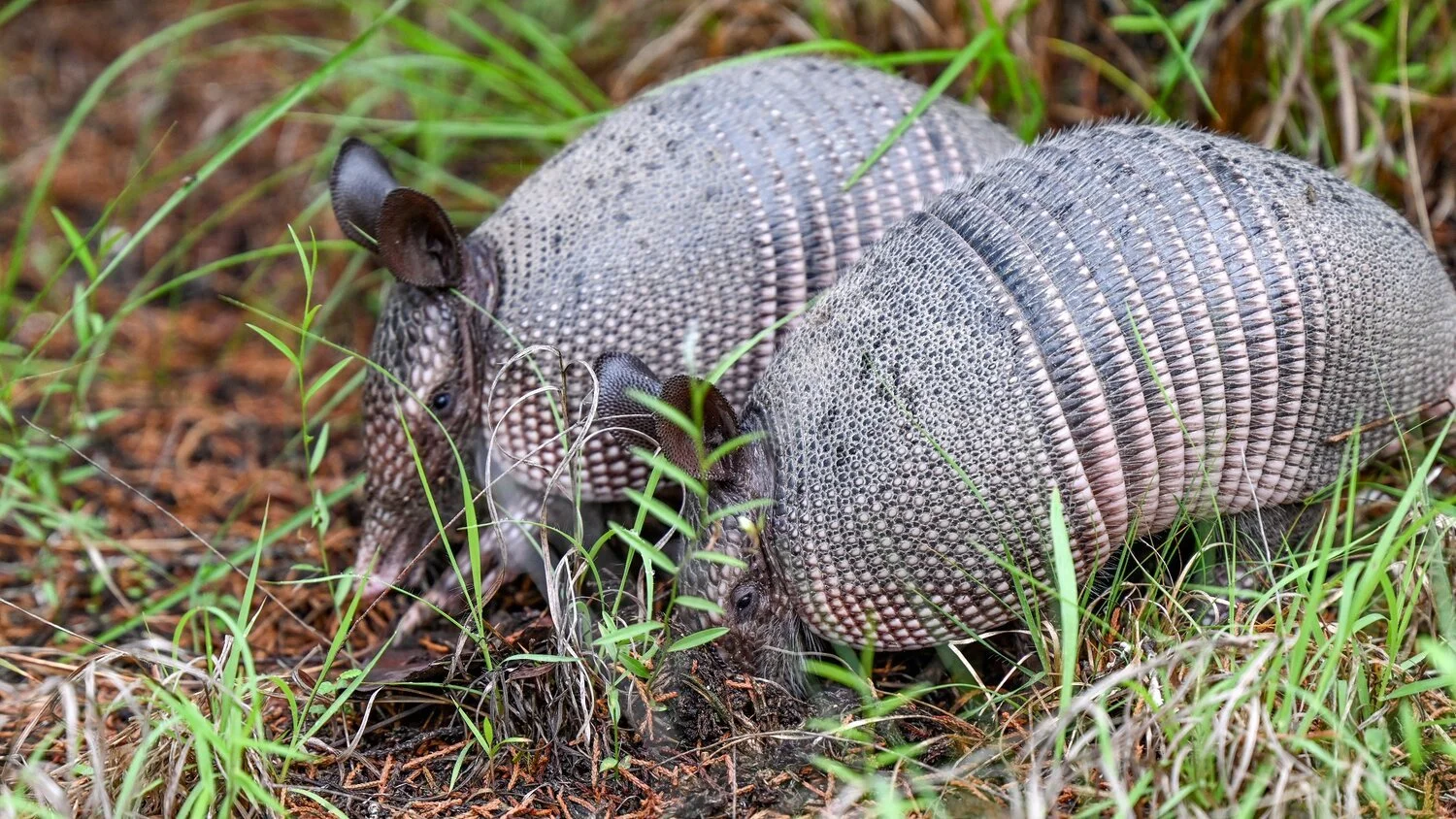
Mary O’Hara’s close encounter with a ‘dillo— “When it headed toward me, I froze in situ. It literally licked my toe! Thought I would faint with delight…feeling so honored!”
Video by Mary O’Hara
Special touches by Dick McBride
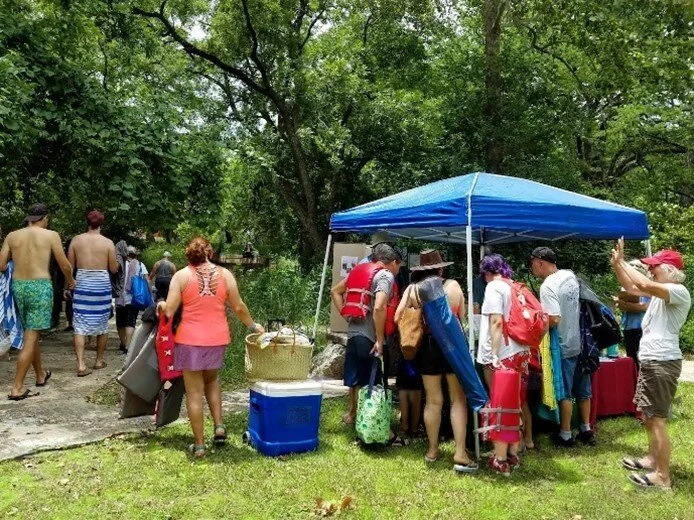
Blue Hole Park in Wimberley Texas—entrance to the natural swimming area
It was swimming weather on July 16, 2021, in Wimberley—the heart of beautiful Hays County, Texas. Birds thronging trees and trails in Blue Hole Park were oblivious to their relatives’ photos and nests on display under a tent near the swimmers. These were only eight of the most common species selected from 127 current year-round birds sighted at Blue Hole Park, according to Cornell Ornithology’s citizen science database, eBird. Of course, all of Hays County currently reports 347 year-round species, with its top hot spot at Aquarena Springs in San Marcos. Since Hays County boasts a confluence of riparian, Blackland Prairie, and Edwards Plateau wildlife habitats, it’s a Texas birders’ paradise. Blue Hole’s hiking trails and crystalline 70°F water are open on a schedule to the public. It’s perfect for bathing, birding—and nature education!
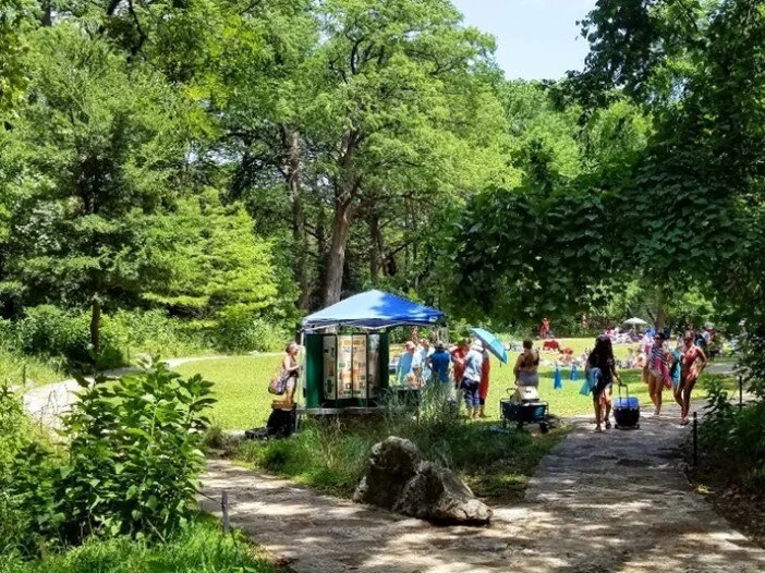
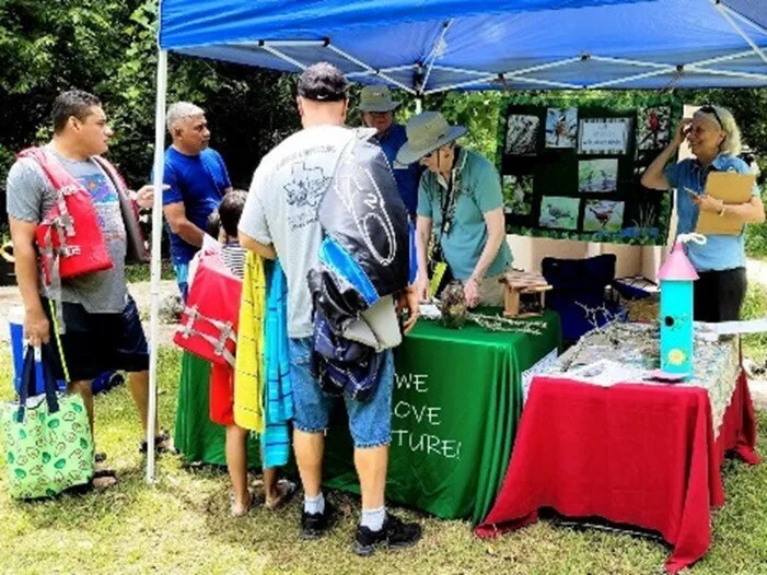
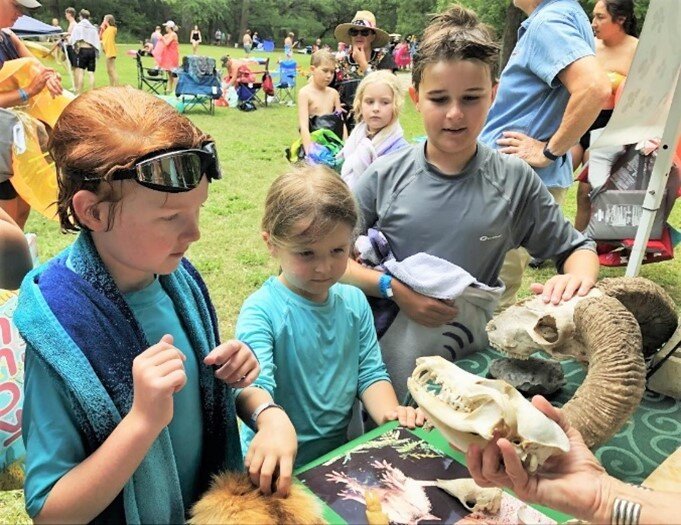
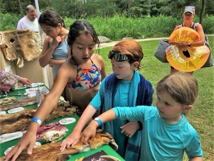
On this hot Friday morning, picnicking families alternated with young day campers for a chance to plunge into deep green liquid enchantment. They would all be clients for the Hays County Master Naturalist Wild About Birds event, the third of several themed presentations of this Texas Master Naturalist™ chapter’s nature education outreach program Wild About Nature (WAN). You can see the WAN volunteers’ first Blue Hole outing, Creepy Crawlies, June 25, in the July issue of this Magazine. The second event, on July 2, hosted by Deb Bradshaw, Debra Kennamer, and Jamie Pettit, was Hide and Seek, featuring tracks, scat, skulls, and skins—all touchable! Look at those little outstretched hands.
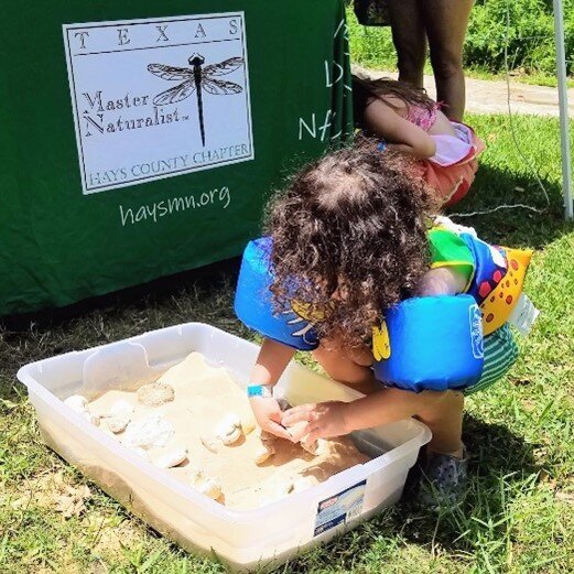
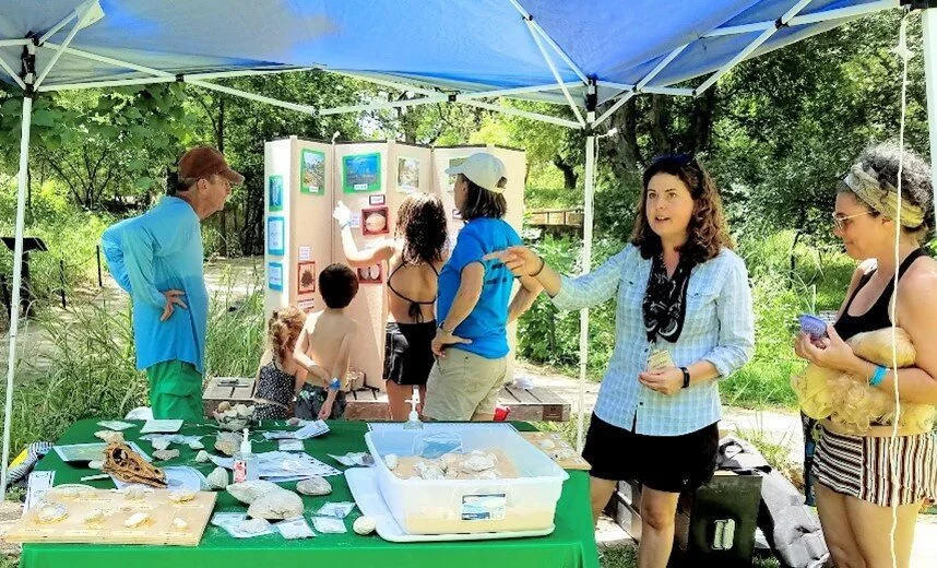
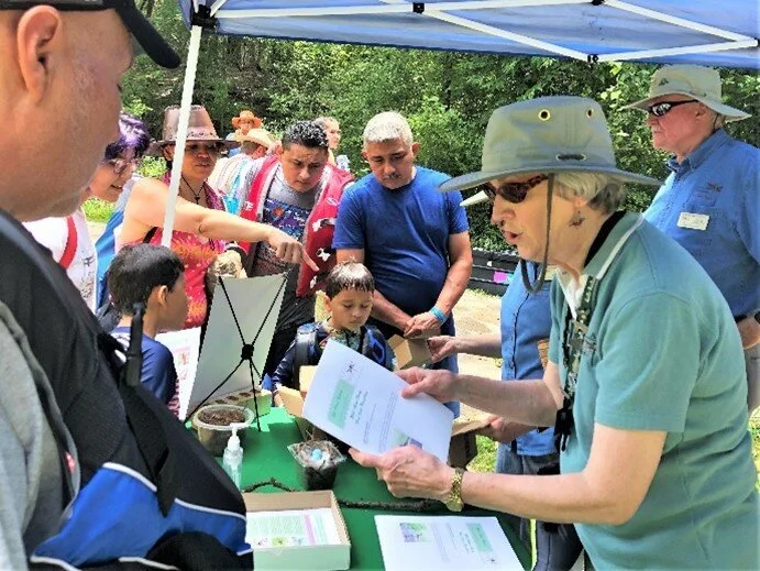
On July 23 the show was Hays County Fossils, including a simulated archeological dig in a sandbox. Team Deb Bradshaw, Debra Kennamer, Jamie Pettit, and Lin Weber hosted more wide eyes and little hands. A party of adult visitors from California were open mouthed at our plaster cast of a Canyon Dam Gorge dinosaur track as big as a coffee table! We’re learning that anything dinosaur is sure to please. And Chris reports: “Deb and Debra discovered the key to drawing a crowd: take something compelling around to the people and invite them to stop by the table. Fossils tallied record numbers—over 80 people!”
Deb Bradshaw, who has done most of WAN’s coordination with Blue Hole Park, would like to tell MNs, especially the new ones, that volunteering with this education outreach “is the perfect way to start sharing your expertise with the public. The material is pretty basic, but for the not-yet-nature lover, it’s exciting new information. It’s so rewarding to see kids and adults light up with a new idea.”
The Hays Humm will bring you more on WAN. But let’s get back to the Birds on that July 16th Friday.
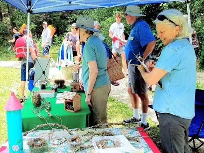
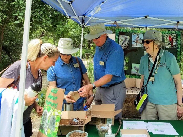
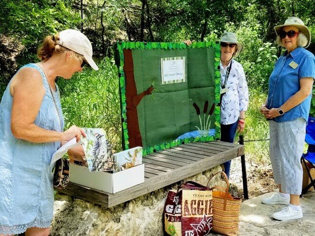
Together with WAN Program Leader Christine Middleton, the Wild About Birds team were Carolyn Bauknight, her husband Wayne Bauknight, Neeta and Roger Allen, Deb Bradshaw, Mimi Cavender, Melanie Webb, and Lin Weber. Carolyn had produced attractive, information-rich, grab-and-go handouts for visitors to enjoy at their leisure. Chris Middleton kept tallies of visitors to the exhibit table. By her count, more than 60 participants—children of all ages and their parents—spent time around the display, chatted with the volunteers, compared the birds at their house with our eight, oooohed over the hummingbird nest, and poked their fingers into the bottom of other nests from cardinal to wren to titmouse. Carolyn recalls, “One parent was particularly interested in going through the grab-and-go bird information and activities with his young son, and another parent, from out of state, thought we were doing a good job encouraging parents and kids to enjoy birds and nature.” We all remember the very little boy who crowed to us that he’d already seen “two Golden-cheeked Wobblers!” None of us under the tent had ever seen any.
And they could do the scavenger hunt! Around the swimming area’s paved “trail,” the team had placed eight big laminated portraits of the birds these young people and their folks are most likely to see here and in other Hays County locations. Kids walked the trail, spotted the birds in trees, shrubs, or grasses, and checked them on their hunt sheet. An 11-year-old came back triumphant. ”I got ‘em all!” Was it too hard or too easy, we asked. “They could’ve been hidden more, but I guess this is good for the little kids.” Her feedback is important to the WAN nature education teams as we develop more games and materials for a variety of events already shaping up around Hays County for the fall and into next year.
The excitement can get dramatic. One little 9-year-old camper and two slightly older girls actually gave up their chance to swim and rushed off on our birding trail, checklist in hand. Halfway through, all three paused the hunt and seemed to be in heated discussion before the older two ran off to swim. The little one came back to us, near tears. “Those girls wouldn’t stop and read the information! They just wanted to find the next bird! I wanted to read it to them, but they wouldn’t let me!” Only very briefly ruffled before heading off to swim, this smart future Master Naturalist melted our heart. She said she’d take the handout home and read it to her mom and dad. She’s proof that parental involvement in nature education—in any education—is key. Our work here has only just begun.
Click on the handout, and since you’re a big kid, can you match the description to the bird? Then you can go swimming.
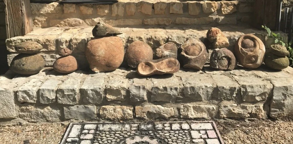
“Can you help us explain these strange rocks we found on Steve Wilder’s property where we did a HELM visit today?”
Steve & Cecile Wilder
When I moved here in 1991, my children were 10, 8, and 6. The front and back meadows were visualized as playing fields, and the rocks were my enemies. In moving them, we found curiosities and artifacts, and the rocks became decorations and borders. Now, they are history teachers. - Steve Wilder
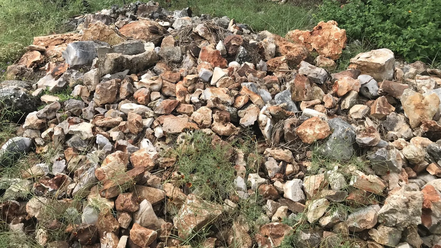
I immediately knew the answer to Christine’s question. The rock looked like a sack of geodes. I have seen similar rocks at Patty Duhon's property and at the Gay Ruby Dahlstrom Ranch and Nature Preserve, a 384-acre tract of land in Buda operated by the Hays County Parks. The presence of flint and geodes is good evidence that Steve’s property is on the narrow flint belt stretching across southeastern Hays County. The flint is from the lower Edwards Formation, part of the Fredericksburg Group, better known for the famous Edwards aquifer. I scheduled a site visit to get a closer look at this interesting geology and help Steve learn more about the strange rocks on his property.
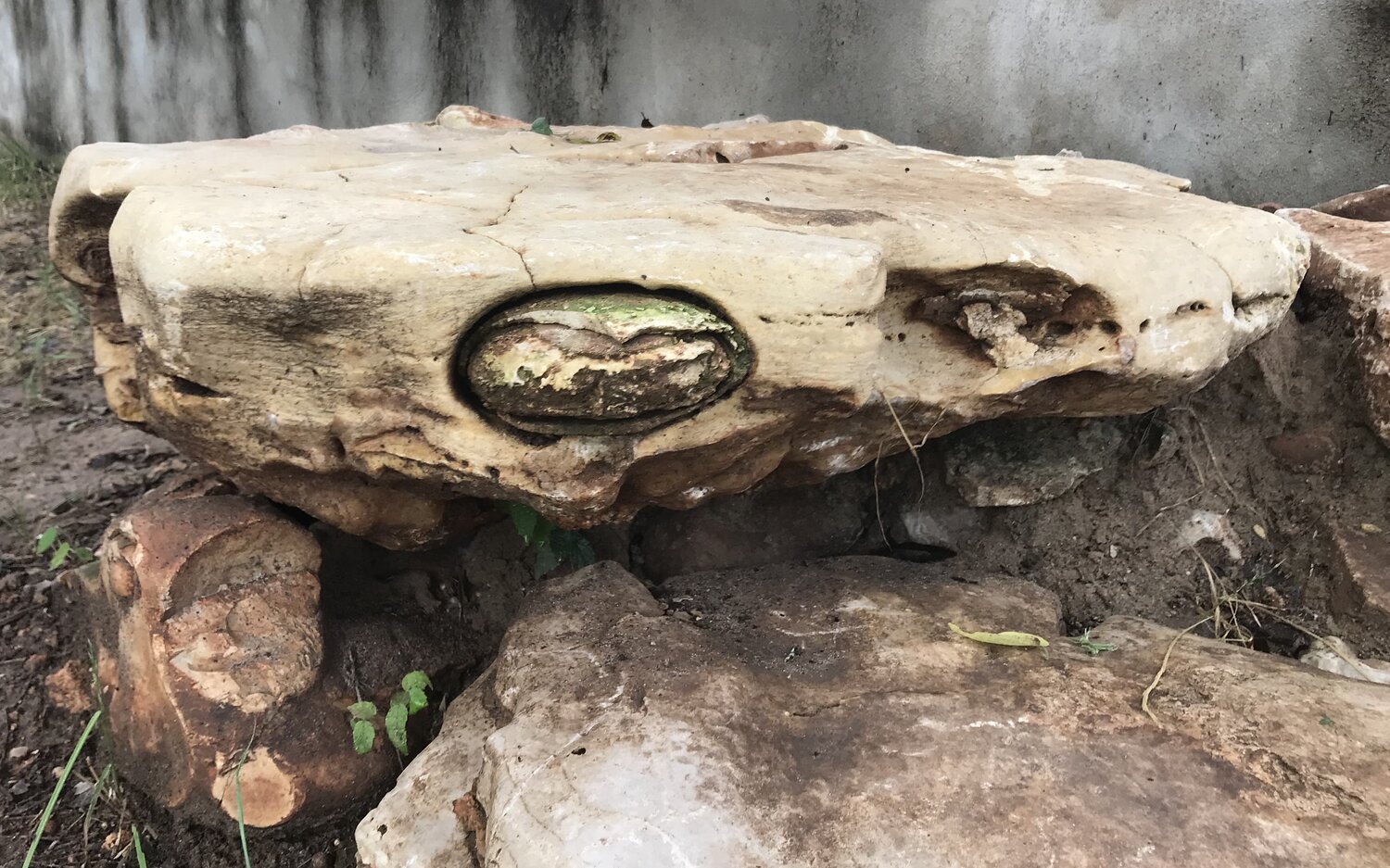
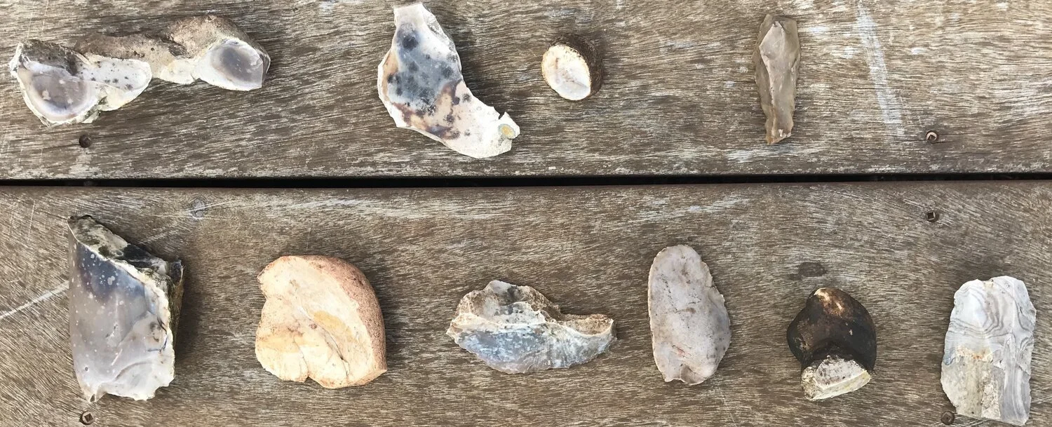
When I arrived Steve and Cecile gave me a tour. The first thing I noticed was their many favorite geodes stacked on the wide patios next to their house. There were rock piles with flint, limestone and geodes created when they cleared their property. The flint was in many different shapes and colors typical of what I have seen at other locations within the Hays County flint belt. Click to enlarge the photo to the right and you can view the large pieces of worked flint they are holding. Cecile is holding a flint tool that looks to be chopper shaped from the flint deposits near their property. Steve is holding a piece of flint that has only been roughly shaped. There is good evidence that early human populations on this site discovered and used the flint from this area in their everyday lives.
The science behind how flint, chert, and limestone are formed.
Flint, a variety of chert, is an interesting sedimentary rock that can be found in many areas of Hays County. It is a hard and durable mineral formed from the silica (quartz)-rich skeletal remains of marine organisms such as diatoms. Flint refers to the type of chert deposited in limestone. It is formed into large spheres (geodes), nodules, or in layers referred to as ledge flint. It is common to see a layer of limestone covering the outside of the nodules, typically white and rough in texture. Flint varies greatly in color from white to black, but it most often manifests as shades of gray, brown, grayish brown, light green and blue.
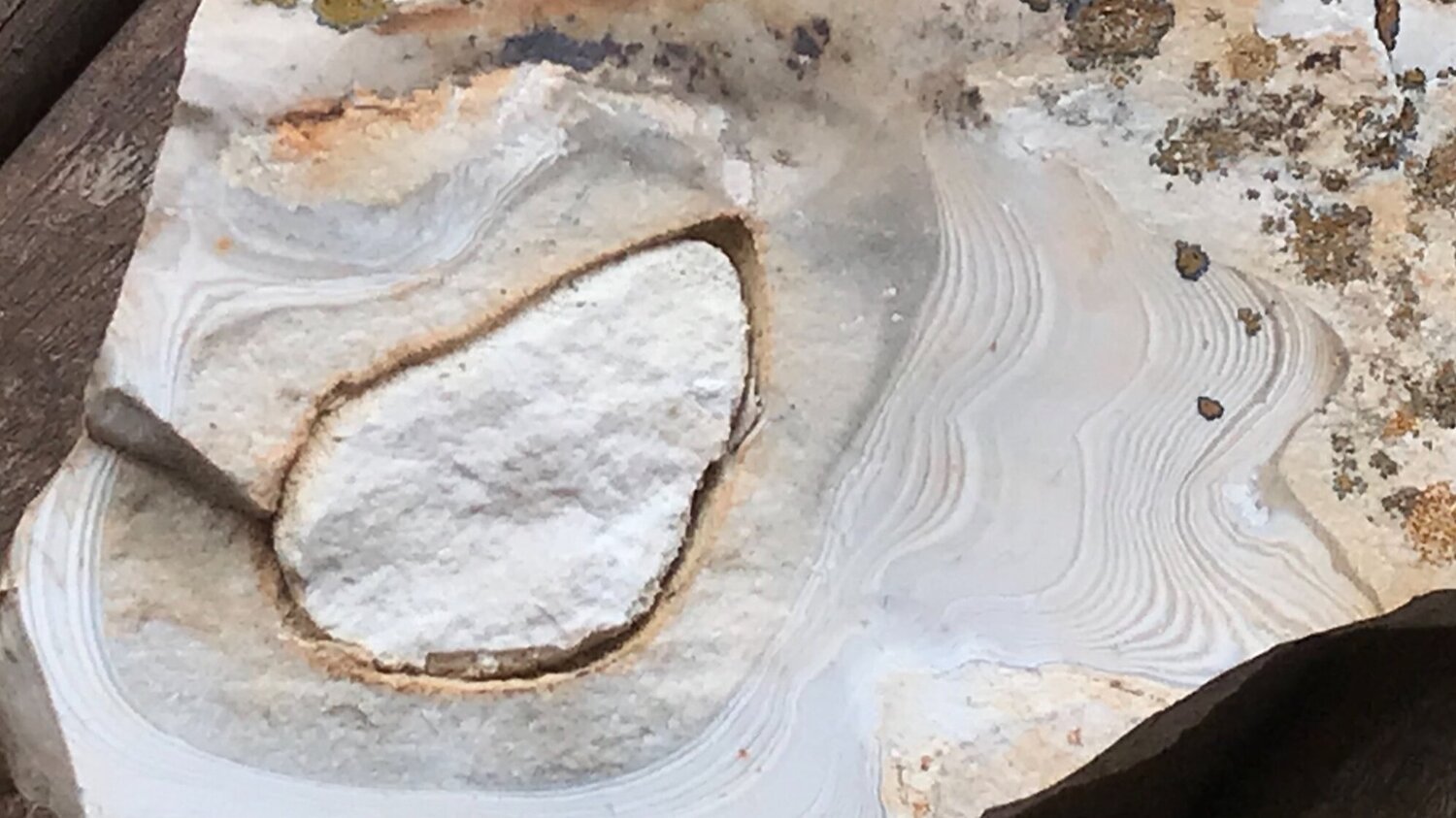
Peanut-shaped geode
About 90 million years ago most of Texas was covered by an inland sea. Large populations of very small organisms such as diatoms and radiolarians lived in the shallow sea covering central Texas. They created tiny skeletons made of biogenic glass or silica. Over very long time periods, their silica remains formed siliceous oozes in thick deposits on the sea floor. This process was relatively rare and made up only about 15% of the sea floor sediments. Both the limestone and flint were formed concurrently.
Another notable location is the famous Georgetown flint in Williamson County. Georgetown flint is the name given to an unusually good chert variety that occurs along the eastern fringe of the Edwards Plateau. Numerous artifacts include large and especially thin bifaces which were made from this material. It is noted that flint deposits in Hays County are regarded as a ‘close cousin’ to Georgetown flint. Read more from an interesting article here.
Visiting the Wilder property was an incredible experience. Next time you are walking on your property after a good rain, keep your eyes on the ground and you may be surprised at what you find.
Two geodes embedded into karst limestone

Thank You Contributors
Marilyn Brister, Mimi Cavender, Art Crowe, Nancy Hernandez, Dick McBride, Mary O’Hara, Constance Quigley, Lacey Smith, Steve Wilder
I have lived in Texas since 1963 and thought I knew Texas plants well after studying books on native plants, grasses, and trees. Participation in a Bioblitz sponsored by the City of San Marcos Discovery Center last fall showed me I was wrong, very wrong. In that contest one had to photograph native plants and find out their names by taking pictures on a cell phone and identifying them with the help of iNaturalist. In this endeavor I started noticing plants that I had overlooked before. One of these plants was a low, small, silvery-green plant with long pointed leaves of three to four inches that looked like it could be in the succulent family. It grows almost entirely on a path of decomposed granite that goes around my country home, and it grows nowhere else on my property. It has leaves near the base, a few more about six inches higher, and then a thin stalk rises to the height of about two to three feet if we have plentiful rainwater, as we had this year in Hays County. At the top of the stalk are very small white flowers, 0.3 to 1.2 inches long, that become a small woolly white fruit that looks like cotton.
In consulting sources on the internet and books on wildflowers, I found that this plant is native to Texas and many other states. Its seeds are airborne, and the plant is often seen in sandy and rocky soil and along railroad tracks. Its scientific name is Froelichia gracilis. Its family name is Amaranthaceae. There are other Snake Cotton plants in this family that vary a little from Slender Snake Cotton. Geyata Ajilvsgi shows Froelichia floridana and Froelichia arizonica, both similar plants in her book on Texas wildflowers. Campbell and Loughmiller show Slender Snake Cotton, and Marshall Enquist also shows Slender Snake Cotton. It is not listed in Native Host Plants for Texas Butterflies by Weber, Weber, and Wauer, though I have seen an occasional small grasshopper and a praying mantis on the blooms. One source stated that deer like it, but it makes poor food for cattle. I'd like the deer to come eat a path through my bed of Slender Snake Cotton!

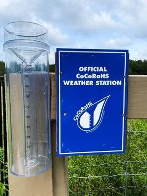
During the pandemic, CoCoRaHS reporting became one of my go to ways of getting Master Naturalist hours (803FR). There isn’t an easier way to pick up 2.5 hours each month. I started doing daily CoCoRaHS reports back in 2016, and in 2019 I upped my game by adding weekly Conditioning Monitoring reports. I was curious to know what percentage of people who submit daily reports also submit weekly summaries. So I reached out to CoCoRaHS directly and they provided me the information I wanted. Over the past 12 months, there were daily reports from 24,680 stations from all 50 states, D.C., Canada, Puerto Rico, and The Bahamas. Texas accounted for ~10% of the reporting. As for weekly Condition Monitoring Reports for the country, there were just 1,705 stations with at least one report, only about 7 percent.
There are a couple of reasons for doing a weekly summary of anything important. It gives you a long-term view, a historical perspective, once you have done it long enough.
The CoCoRaHS website makes it easy for you to enter a Condition Monitoring report for your CoCoRaHS site. Go to:
https://www.cocorahs.org From the Main Menu on the left, select Resources > Condition Monitoring > Regional Guidance >All Regions. Scroll down to the Southwest Region. You’ll find practical examples of what the seven different categories of relative wetness mean in the Southwestern part of the country. There are also nine different categories of observation types to choose from. Choose as many as you are comfortable with.
I tend to use the same categories each week: general awareness, fire (e.g., burn bans), plants and wildlife, water supply and quantity. I am particularly fortunate to be located close to a USGS gauge with a 94-year period of record. I compare the Blanco River’s flow in Wimberley (USGS gauge 08171000) to the long-term median (50th percentile) or the 25th percentile of flow. The reason for using these statistics for comparison rather than the average flow is that high flow events during floods skew the average. Stream flow is not normally distributed. Therefore, it is best to use non-parametric statistics such as percentiles.
It is easy to see from this one graph just how low the flow has been over the last year compared to the historical record. Very few times in the past 12 months did the flow exceed the 50th percentile (median) and much of that time it was below the 25th percentile of flow.
You don’t have to submit a Condition Monitoring report to view them, however. Just go to CoCoRaHS’s home page, click on Maps on the top bar, and then go to Condition Monitoring maps. This is where you will find the data that the seven-percenters post each week. I have found it particularly interesting recently, with all the extreme weather that is occurring across the country, to check Condition Monitoring reports from out West, where there is extreme heat and drought, and compare to the Coastal Bend of Texas, where it is wetter than usual. There are also a number of interesting weather related articles on the CoCoRaHS blog which can be found right next to the message of the day.
Cornell just launched an add-on feature in their Merlin app—Sound ID. If you haven’t downloaded it yet, I recommend giving it a try. If you’ve used Cornell’s earlier stand-alone BirdNET app to identify bird songs and calls, you may find Merlin’s Sound ID even more delightful. Here’s a review of my field experience and early impression of both applications.
In June, I’d just begun using BirdNET to record and analyze bird songs in the field. While I was at Jacob’s Well rounding the bird boxes, I heard a distinctive bird call that I could not identify, so I pulled up BirdNET and ran the recording. After a bit of fumbling with the app to select the exact recorded section for analysis, BirdNET provided an answer. With very high certainty, it was the Yellow-throated Vireo. I was hooked! I’d heard this bird before in previous years, but had no way to understand what it was. I’d never seen a Yellow-throated Vireo, so I pulled up my Merlin app to get a little more information about the Yellow-throated Vireo and to hear Merlin’s reference sounds for added confirmation. The song at the top of Merlin’s list matched perfectly to what I was hearing. Merlin’s map showed our location to be along the edge of its breeding range. The ID Info in Merlin indicated that it breeds in mature deciduous forests in eastern North America, often near water. This Jacob’s Well mystery bird seemed to be high up in the canopy of a mosquito infested area of tall vegetation along the tree-lined creek edge. Even though I was unable to spot the bird or get a photo, it all added up.
Then, in July when I read that Merlin’s Sound ID was released for general availability, I upgraded my Merlin app and tried it out. The screen shots below provide a step-through of the basic workflow for using Sound ID. It’s quite a bit more automated than BirdNET. When you hit the record button, it immediately begins to listen to all the bird songs. It automatically starts a running list of everything it hears (see the third screen shot). Working in a dynamic fashion and in real time, it highlights each bird in the list as it continues to hear them. In my example below, Sound ID picked up a Yellow-throated Vireo, but it also heard a Northern Cardinal and a White-eyed Vireo. It automatically stores your recordings, and you can return to them anytime. Because it’s integrated with all the other Merlin features that I’ve come to depend upon, you can review exemplar recordings and other critical information provided in the Merlin app right there with your own field recording.
At the home screen, select Sound ID.
Click the microphone icon to start a new recording. You can also return to previous recordings from here, or you can see a list of the 458 birds currently supported.
The app creates a running list of birds it hears. It highlights the row again as it hears the same bird. Watch it work and correlate it with what you are hearing in real time. To access specific info, pause the recording and click the dropdown arrow on that row.
After clicking the dropdown on a row, choose an exemplar recording of a song/call or continue down to select This is my bird, start a new recording, or Details for more ID info, map, photos, etc.
Both BirdNET and Merlin Sound ID are free products from The Cornell Lab of Ornithology. Perhaps I am still a novice user of BirdNET, but I can say that for me, the usability and performance of Sound ID in the field is superior to BirdNET. I’ve begun using it to test the more granular aspects of bird songs. When I hear a bird as I’m walking the trail, I will name the bird to myself and then test the guess against the Sound ID “expert.” I’ve found Sound ID to be intuitive, easy to use, and informative instream. It’s helping me tune in to the finer details that differentiate similar bird songs. Besides expanding my ID skill set, I believe this solitary game of listening for nuance, testing on the spot, and immediate confirmation or correction is strengthening my hearing and improving my attention.
But that’s not the end of this story. In an unrelated conversation with Hays Humm editor Steve Wilder, he told me about a fledgling that he’d photographed with his cell phone. At first he thought it was a goldfinch fledgling, but he uploaded the photo to iNaturalist and received several responses—it was a Yellow-throated Vireo. He sent me the photos below.
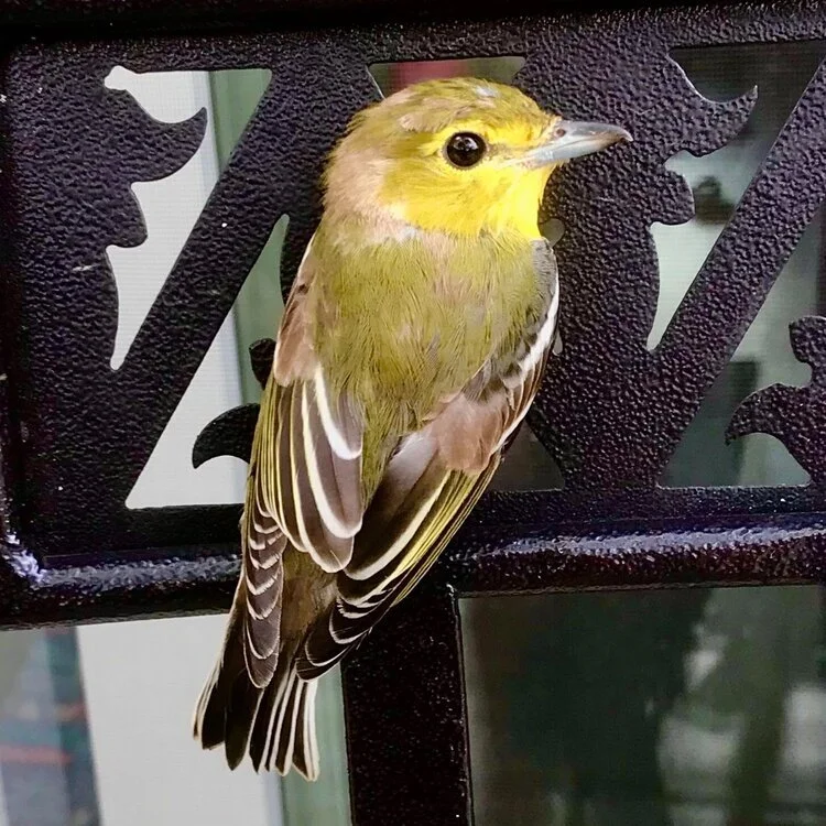
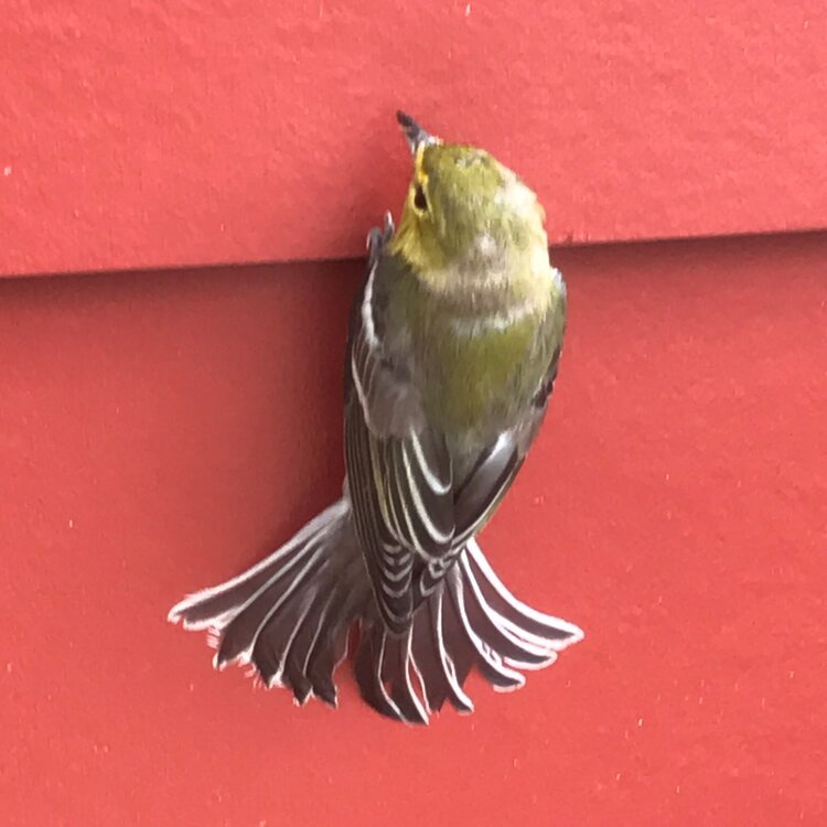
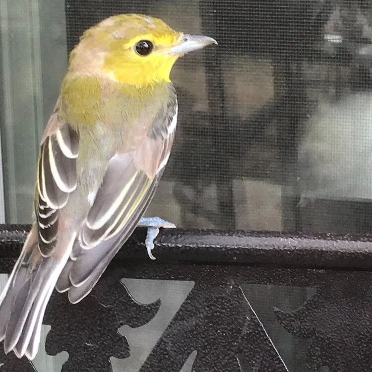
When I need ID confirmation on a bird photo I’ve taken (almost always with my regular camera), I will often upload it to my phone and run it through Merlin’s Photo ID. Compared with images of the Yellow-throated Vireo, Steve’s excellent photos matched well with ID references online. But out of curiosity, I ran Steve’s pictures to see what Merlin had to offer. The confirmation gave me additional confidence that the mystery bird at Jacob’s Well was in fact a Yellow-throated Vireo, that the Yellow-throated Vireo is breeding and thriving across Hays County, and that Merlin’s Sound ID was likely accurate. Thank you, Steve! My next step is to spot one and photograph it for my own records.
At the home screen, select Photo ID. Then, select Choose a Photo and follow the steps to upload your pic.
Adjust your photo to fit the box and click Next to select your location and date. Then Identify. **This is one of Steve’s actual cell phone shots.
Merlin provides one or more suggestions, listing its 1st choice on top, followed by others to consider. Select one to see more info.
I selected the Yellow-throated Vireo. Merlin’s photo and description fit well, and especially the “thick, slightly hooked bill”, which you can see clearly in Steve’s photo.
To obtain more details about Sound ID, check out this June 23 article What’s That Bird Song? Merlin Bird ID Can Tell You.
The Uplands, Westcave Preserve - Photo © Nancy D. Hernandez
Members of the Hays County Master Naturalist Armadillo class (2021) and friends in the Corona de Cristo class (2020) beat the heat on Sunday, July 25, at one of the Hill Country's finest gems, Westcave Outdoor Discovery Center. Westcave's Lindsay Loftin led the steep descent down to the gorgeous Grotto and asked the trainees to cup our hands behind our ears to practice active listening far from the ceaseless weekend traffic along Hamilton Pool Road. She asked, "How many distinct natural sounds can you identify?" The swishing of the enormous cypress trees, the calls of wrens, titmice, and chickadees, and the soft trickling of the creek created a soothing listening experience. As we reached the bottom of the canyon, we were greeted by perhaps the greenest oasis in the Hill Country. The waterfall cascaded into the pool below, and the lush greenery framed a scene straight out of Jurassic Park (pre-dinosaurs, of course). Trainees ascended the rocky stair to revel in the view from behind the waterfall and the comfortable temperature of 76°F there. In the adjoining cave, the temperature dropped to about 72°F—a wonderful reprieve from the blistering world above. We admired the cave formations and practiced active listening again to appreciate the soundscape of the slow drips of water in the cave.
Back on the surface, Westcave's Amber Ahrns Gosselin took trainees on a guided walk through the newest part of Westcave Outdoor Discovery Center—the Uplands. The Uplands were added to the Westcave property in 2008; their native plants and grasses help preserve water quality in the Grotto. The Uplands are home to a beautiful restored prairie and lots of native flora and fauna. This natural habitat is complemented by human-made habitat, such as a chimney swift tower and a bat house that was installed with consultation from Dr. Merlin Tuttle, one of the world's foremost experts on bats and bat conservation. The exterior of the bat house isn't much to look at, but it is much bigger on the inside—it can house between 1,000 and 2,000 bats!
The Grotto and the plunge pool
Photo by Lacey Smith
The waterfall deposited limestone in the Grotto, forming a column
Photo © Nancy D. Hernandez
Thank you so much to the staff of Westcave Outdoor Discovery Center for hosting us on a hot Sunday morning. They have lots of volunteer opportunities available for Master Naturalists eager to share their love for this land with Westcave visitors. You can learn more at https://westcave.org/.